Layers you can see
These aren't mockups — they're screenshots of the live map. Shadows computed from the national elevation model, planned roads and railways, transaction prices for districts and single buildings. Every layer is one click in the ⊕ catalog.
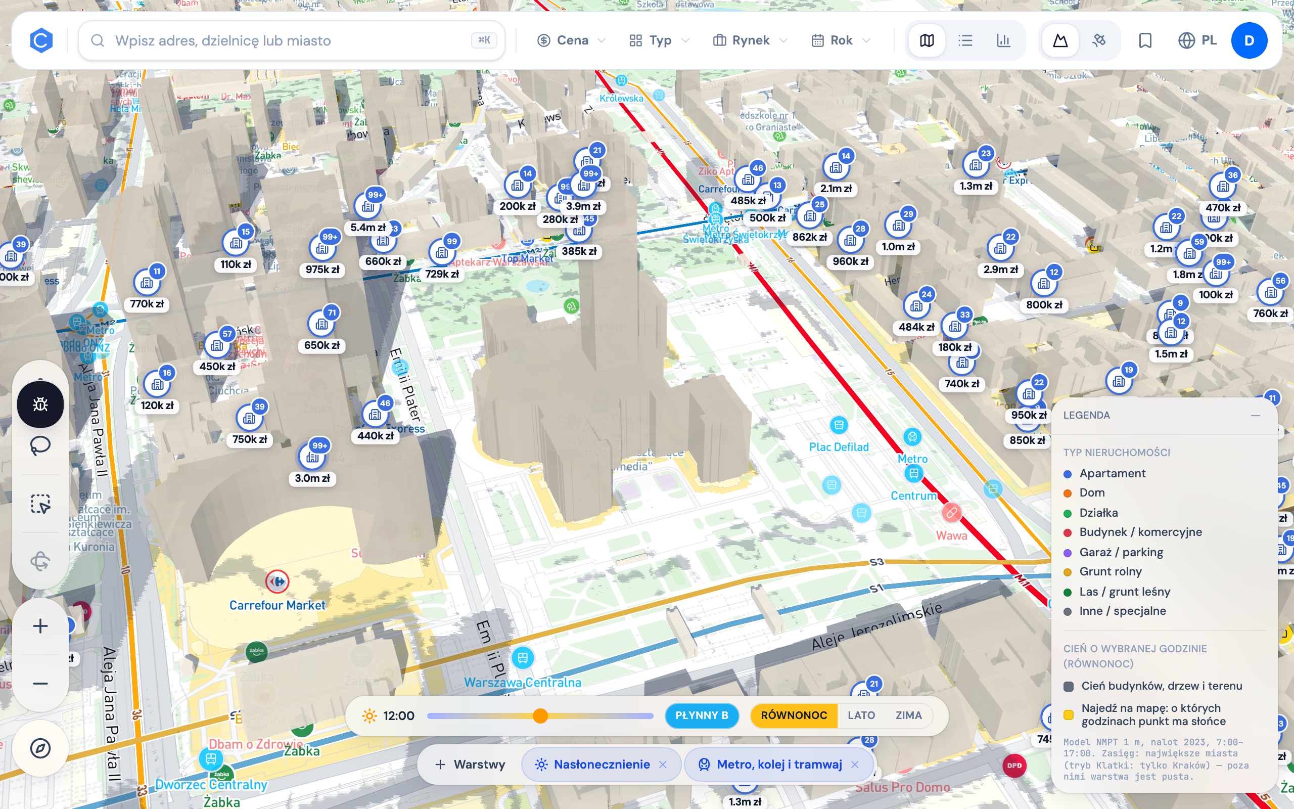
Sun exposure — Warsaw
Building shadows computed hour by hour from the national LiDAR elevation model. Hover any point and the map tells you from what hour to what hour it gets sun — here, the Palace of Culture at noon, equinox.
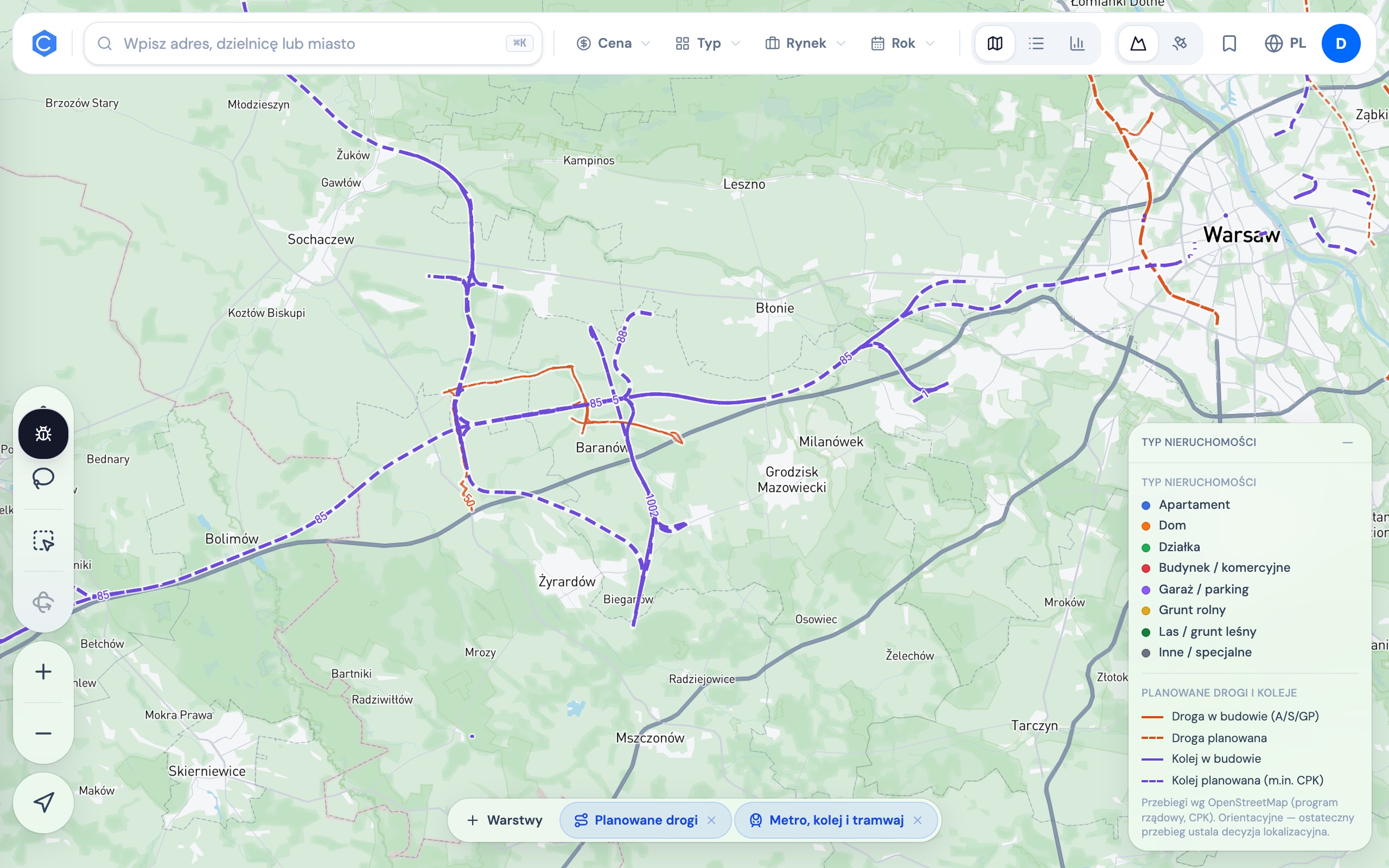
Planned roads & railways
Road and rail corridors in preparation — including the CPK spokes. A parcel by a future ring road is a different investment than one by a future motorway.
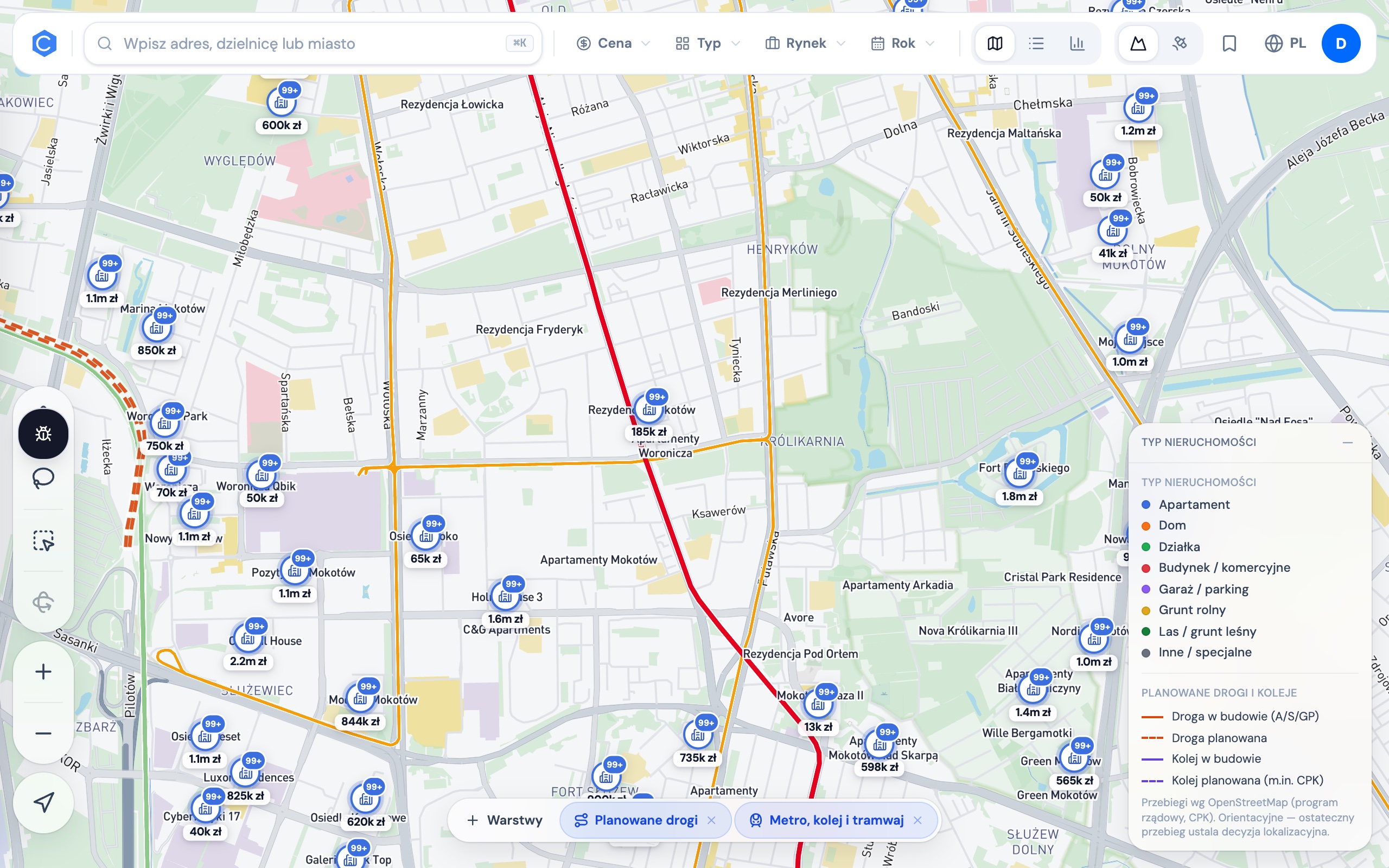
Transaction prices, not listings
Every marker is a signed notarial deed with price, area and date. Colour separates apartments, houses and land — here, Mokotów.
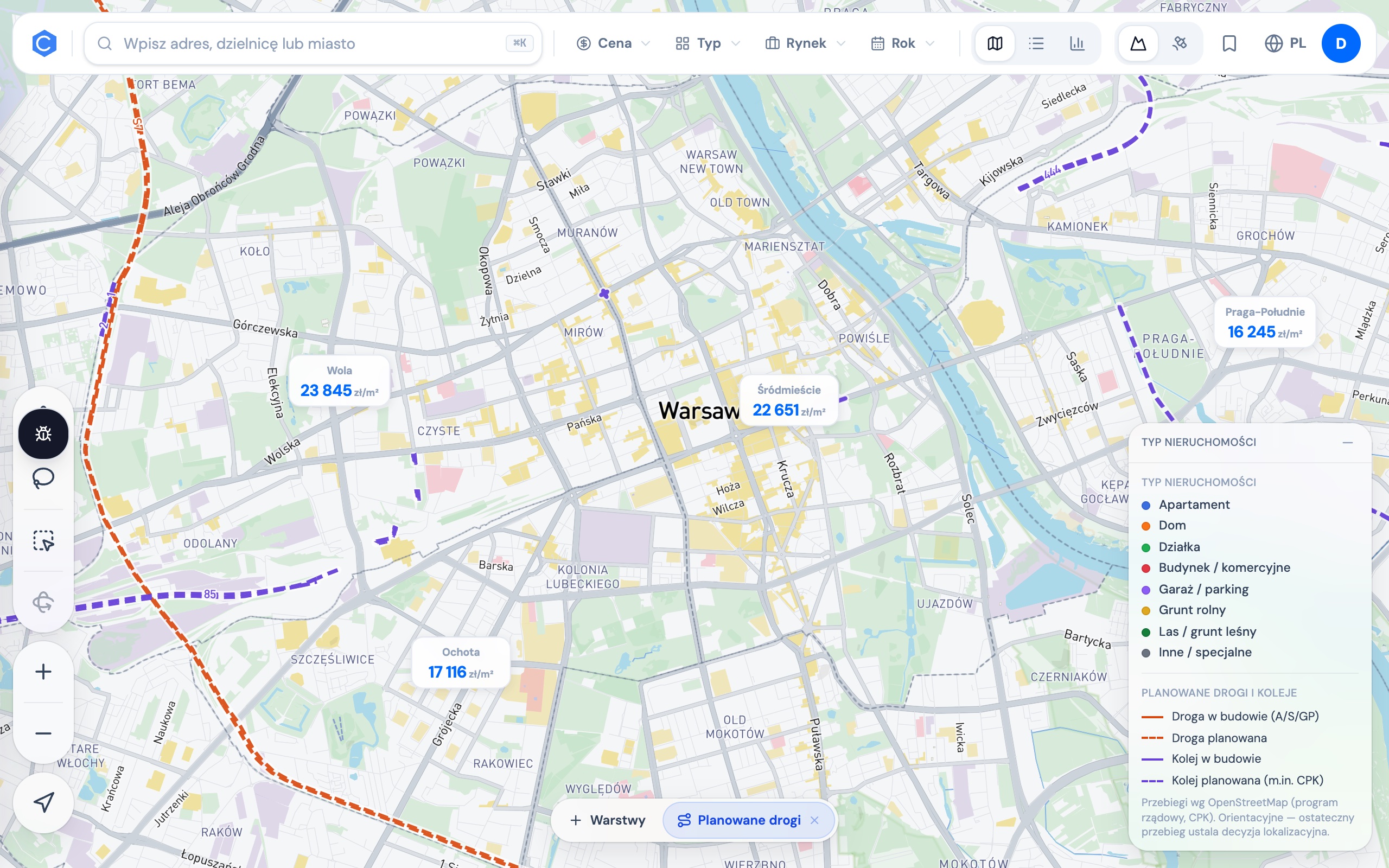
Districts and planned infrastructure
District median prices over planned roads and railways — the ring road under construction to the west, planned lines on the Praga side. Where infrastructure goes, prices follow.